Samuel Wright (1840/07/08)
Koombana Bay
Samuel Wright was built at Portsmouth, New Hampshire, in the USA, and was partly owned by J.B. Osgood, a merchant of Salem, who was also the manager of the vessel. It had two decks, a square stern, billet head and no galleries. Dickson (2007) states that the vessel’s depth was 13.7 ft, while Henderson (2007) gives this same measurement as its draught. The ship had previously visited the coast of Western Australia in 1837. The Samuel Wright under the command of Francis (Henderson, 2007) or Frederick (Bolton, et al. 1991) Coffin, with a crew of 33, departed Salem on 4 May 1839 to go whaling in the Indian Ocean and along the southern coast of Australia. It called at Albany during March 1840, and had obtained 30 tuns of sperm oil, 36 tuns of black oil and 5 tons of whalebone by the time it anchored in Koombana Bay. Also anchored in the bay were two other American whalers, the North America (Captain Kempton) and the Hudson (Captain J. Denison). Another American whaler, the Governor Endicott (Captain McKinstrey or McKennistry), was lying off Toby Inlet at this time.
THE LOSS
On 6 July heavy rain during the day was followed on 7 July by mild gentle weather. However that evening the breeze freshened from the north-east, increasing and shifting north-north-east. ‘At midnight it blew a perfect hurricane’ (Gazette, 18 July 1840: 3d). About sunrise on 8 July the wind shifted to the north, and at 8.00 a.m. went to the north-north-west and blew with ‘unmitigated fury’. The Samuel Wright rode the storm until the seas were breaking over the topmast head, when a chain anchor cable parted. This left the vessel with two anchors down, and these were not sufficient to prevent the ship from dragging. Another anchor, a very large one, was stowed below decks. The crew attempted to bring this up and secure a cable to it. However the cable was of thick hemp and therefore very stiff, so before they could carry out the task the Samuel Wright struck the beach some miles north of Bunbury. According to Captain Coffin the ship ‘stood all the thumping and went up high and dry, without making a drop of water or starting a single seam’ (Gazette, 18 July 1840: 3d). The storm quickly subsided, and by 4.00 p.m. there was only a light breeze.
INITIAL SALVAGE
The Perth Gazette for 18 July 1840 published the following advertisement on its front page:
Two Wrecks For Sale
Sale of the Wrecks
of the
Samuel Wright
and
North America
at Port Leschenault
On Monday 20th Inst.
The Samuel Wright (Capt. Coffin) and North America (Capt. Kempton), as they now lie wrecks, in the Port of Leschenault, will be sold on the above date, with all their sails, rigging, &c, &c.
Leschanault, July 9
Francis Coffin bought the wreck of the Samuel Wright for £305. The sale, with the Government Resident Henry Bull acting as auctioneer, included all the whale-boats and whaling gear. The wreck must have been in reasonably sound condition as, for a while at least, Captain Coffin leased ‘his old ship for deposit of goods when he can persuade people to deposit them therein’ (Marshall Waller Clifton Letter book, quoted in MA 405/71).
Whale oil and bone salvaged from the wrecks of the Samuel Wright and the North America were also sold. The 30 tuns of sperm oil fetched £50 per tun, the 36 tuns of black oil £9 per tun and £90 per ton was paid for the 1½ tons of whalebone. The monies raised by the sale of the oil and bone were to be paid to the crews of the two ships in accordance with their lays.
In 1842 the crew of the whaler Grotius were shown the wreck of the Samuel Wright by a man who had been a boatsteerer on the whaler, and had settled in the area after the vessel was wrecked. At that time the hull of the ship was still in basically sound condition, but with its back broken from coming to rest on a bar, with the sand being scoured from under the bow and stern sections.
SITE LOCATION
On 27 December 1841 HMS Beagle sailed in to Koombana Bay to collect ‘Mr Forsyth [Charles Codrington Forsyth], whom I had sent over land’…and who had ‘completed the survey of this anchorage, and Leschenault Inlet, which it joins in the south corner by a narrow boat channel’ (Stokes, 1969 (1846): 395). Commander John Lort Stokes goes on to note ‘the wreck of a large whale ship in the head of the bay shows the folly of attempting to ride out the winter gales to which it is exposed…’. This wreck would most probably have been that of the Samuel Wright, which was quite prominent for some years after wrecking, as shown by its inclusion on the Reverend John Ramsden Wollaston’s map drawn on 18 April 1843. On this he also depicted the second North America, wrecked only eight days earlier. It should be noted that in the sailing directions prepared by John Clements Wickham and John Stokes mention is made of the wrecks of both the Samuel Wright and the North America of 1840:
Point Casuarina is the southern point of a small opening, known as ‘Port Leschenault’, from which a reef extends about a third of a mile to the N.N.W., and shelters the anchorage from the westward—this does not appear to be a very secure port, as when we passed in the Beagle at a wide distance from Point Casuarina, two American whale ships were lying on the beach having been driven from their anchorages a short time before, during a N.W.erly gale (Wickham & Stokes 1842: 131).
Stokes’ chart of 1841 shows only one wreck, probably the Samuel Wright.
In December 1962 a mineral sands company operating in the area uncovered three wrecks in the sands of what had been part of Bunbury’s northern beach. It was believed that the northern most one of these was the Samuel Wright.
SITE DESCRIPTION
The wreck of the Samuel Wright is now buried many metres under sand and lies under a carpark at approximately the latitude and longitude given above. When first uncovered by mining operations in 1962 it was found to be standing almost upright, and lying in an approximately north-south direction. The wreck was later reburied.
As the Samuel Wright was not seriously damaged when it came ashore, and came to rest in an upright position, it was able to be used for some time as a storehouse by its owner, the captain turned entrepreneur Francis Coffin. For this reason it seems likely that the hull excavated in 1962–63 and shown in the accompanying photograph is that of the Samuel Wright.
Position taken from rectified Wolleston’s chart
Ship Built
Owner J.B. Osgood
Master Francis Coffin
Country Built USA
Port Built Portsmouth, New Hampshire
Port Registered Salem, Massachusetts
When Built 1831
Ship Lost
Grouped Region South-West-Coast
Sinking Beached
When Lost 1840/07/08
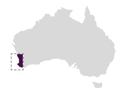
Where Lost Koombana Bay
Latitude -33.322233
Longitude 115.649211
Position Information Historical map GIS
Port From Fremantle
Port To Whaling ground
Cargo Whale oil
Ship Details
Engine N
Length 33.50
Beam 8.50
TONA 372.00
Draft 4.20
Museum Reference
Unique Number 455
Sunk Code Wrecked above water
File Number 2010/0037/SG _MA-405/71
Chart Number PWD 50976
Protected Protected State
Found Y
Inspected Y
Confidential NO