Voyages of Grand Discovery
Home Timeline About The Exhibition Education Resources Feedback Shop Acknowledgements
In Search of the Great Southland
Past Before Time
Dirk Hartog
Houtman
Willem de Vlamingh
William Dampier
Nicolas Baudin
Saint Alouran
Matthew Flinders
de Freycinet
Lines of Fate
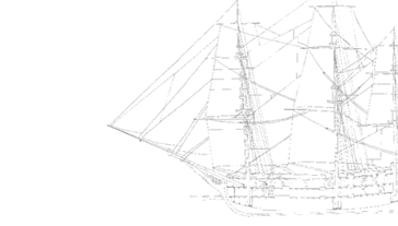
Among the ships leaving Texel (The Netherlands) for the East Indies in the spring of 1616 was the Eendracht (Unity) sailing for the Chamber of Amsterdam of the Verenigde Oostindische Compagnie (VOC), the United Dutch East India Company. Dirk Hartog was its skipper and Gillis Miebais the upper-merchant.

Near the Cape of Good Hope the Eendracht became separated from the rest of the fleet. For the sake of speed, Hartog embarked on a new sailing route, sailing eastwards between latitudes 35° and 44° south where the prevailing winds were strong and westerly. This southerly route, pioneered by Hendrik Brouwer in 1610, had yet to be officially introduced by the Company.

Gerritz Map

Above: Map showing Eendrachtsland: Hessel Gerritz outline chart of 1627.

Hartog maintained this course until October when he saw ‘several islands, though uninhabited’, behind which a vast mainland could be seen. He anchored near one of these islands and examined them thoroughly for two days. He found little of apparent value.

Before continuing his voyage to Bantam (Banten, Indonesia) he erected a pole with an inscribed pewter plate attached to commemorate their discovery.

The roads where he lay at anchor for two days were called Dirk Hartog Roads and the island Dirk Hartog Island.

The Eendracht then sailed northward along the unknown coast, which was charted accurately until latitude 22° south. Hartog called the new land after his ship; Eendrachtsland or Land of Eendracht.

Untitled fragment from Nova et Accurata Totius Orbis Terrarum Geographica et Hydrographica Tabula c.1625

Hendrik Van Langren

This apparently unique fragment from a world map is possibly the earliest printed depiction indicative of  early Dutch discoveries of the west coast and Cape York Peninsula of Australia. On the hypothetical landmass Terra Australis Incognita appear the legendary  names Beach provincia aurifera (land of gold), Lucach and Maletur (Kingdom of the Malays) all derived from Marco Polo.  

When compared to the 1599 edition, it is clear that Langren added the words  t’landt van Eendracht taking into account Dirk Hartog’s discoveries on the Eendracht in 1616

Image Fragement

This  linking of  Hartog’s discoveries with Terra Australis Incognita is  a significant step towards the eventual realization that Abel Tasman’s New Holland, Nicolas Baudin’s Terres Australes and Matthew Flinders’ Australia  were one in the same.

On loan courtesy of the Jock Clough Collection.

Ship
Australian Capital Equity Pty Limited Woodside Valley Logo
WA Government Logo Western Australian Museum Logo