Voyages of Grand Discovery
Home Timeline About The Exhibition Education Resources Feedback Shop Acknowledgements
In Search of the Great Southland
Past Before Time
Dirk Hartog
Houtman
Willem de Vlamingh
William Dampier
Nicolas Baudin
Saint Alouran
Matthew Flinders
de Freycinet
Lines of Fate
Baudin purchased the Sydney built schooner Casuarina in November 1802 and sent the Naturaliste home laden with specimens. He elevated Sub Lieutenant Louis de Freycinet, above more senior officers, to command the vessel. Its shallow draught made it ideal to conduct detailed inshore surveys.

As they traveled along the coast of what they called Terre Napoleon, the south coast of Flinders’ Australia, Baudin and the scientists on the Géographe studied the native flora and fauna while de Freycinet charted the coast line. De Freycinet arrived at King George’s Sound in February 1803, well ahead of Baudin, where he started repairs on the Casuarina. Although claimed for Britain by George Vancouver in 1791 and later surveyed by Flinders, de Freycinet also began a survey of the region.

Baudin arrived, annoyed at de Freycinet’s barely disguised insubordination, and put his scientists to work collecting over 200 specimens, meeting Aboriginal people and recording their shelters. Baudin also charted Oyster Harbour and what he called ‘River of the French’ (the Kalgan River).

The two ships headed west towards St Allouran Island near Cape Leeuwin, then up the west coast into Geographe Bay before eventually arriving in Shark Bay, which de Freycinet charted with great skill.

Though from a later voyage, the views of King George’s Sound by Louis Auguste de Sainson in this exhibition show many similar activities and the features noted by the Baudin expedition.

Above: Louis–Claude de Saulces de Freycinet. Unknown artist c. 1812 around the time of his marriage to Rose Marie Pinon. Copy of an engraving of the original family portrait. Courtesy de Freycinet family.

In particular the views of the Sound, the longboat, Oyster Harbour and ‘River of the French’ reflect the observations of Baudin’s scientists.

The Casuarina is a 30 ton schooner, very badly constructed and worse fitted out. It is too short for its masts. It takes in five inches of water a day. We have to continually pump, it is a very poor seaboat.’ Freycinet Journal. Casuarina 23/9/1801. Reproduced in Marchant, 1998:183.

de Freycinet Carte Générale de la Nouvelle Hollande.
General map of Australia, 1808-1820

Louis-Claude de Saulces de Freycinet

Engraved map of Australia annotated throughout by de Freycinet in pencil, red and sepia ink. This work is considered one of the greatest French Maps of Australia and in its final form appears in the atlas volume of Voyage de Découverte aux Terres Australes.

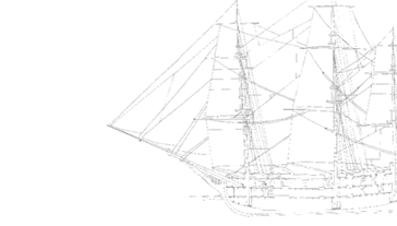
While on this version he is calculating the continent’s land mass, in another instance Freycinet adds English names in red ink, acknowledging Flinder’s prior claims to the discoveries on the south coast. In the bottom left corner are shown the three ships of the Baudin voyage, Géographe, Naturaliste, and Casuarina. The longitude is calculated from Paris.

On loan courtesy of Kerry Stokes collection, Perth, 2002.45

Ship
Australian Capital Equity Pty Limited Woodside Valley Logo
WA Government Logo Western Australian Museum Logo