View Species
Family: Unidentified Decapod(s)
was found at:
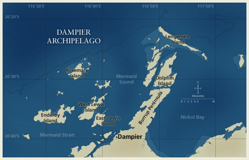
Distribution by Station:
- DA1/98/01 — E side of the N tip of Dolphin Island
- DA1/98/03 — N side of the SE end of Legendre Island
- DA1/98/04 — Off N coast of Legendre Island
- DA1/98/09 — N end of W side of Angel Island
- DA1/98/15 — Cape Legendre at NW end of Legendre Island
- DA1/98/17 — Flying Foam Passage, Wilcox Island
- DA1/98/18 — Bay near the S end of the E coast of Hauy Island
- DA1/98/20 — E side of Collier Rocks
- DA1/98/23 — Large bay on E side of Dolphin Island
- DA1/98/29 — Midway along SW side of Legendre Island
- DA1/98/31 — Island towards E end of Sea Ripple Passage
- DA2/99/03 — Mermaid Sound, E of Cohen Island
- DA2/99/04 — N-NW of Cohen Island
- DA2/99/06 — E-SE of Cape Legendre
- DA2/99/08 — N-NW of the NW point of Delambre Island
- DA2/99/09 — N of the NE corner of Delambre Island
- DA2/99/12 — N-NW of the NW point of Delambre Island
- DA2/99/13 — E of Ha�y Island
- DA2/99/16 — E of Sloping Point, Burrup Peninsula
- DA2/99/17 — E-SE of Sloping Point, Burrup Peninsula
- DA2/99/18 — SE of Sloping Point, Burrup Peninsula
- DA2/99/22 — W-NW of Cape Legendre
- DA2/99/23 — W of Cape Legendre
- DA2/99/24 — N of Lady Nora Island
- DA2/99/25 — N of Rosemary Island
- DA2/99/26 — NE of Rosemary Island
- DA2/99/30 — W of Cape Bruguieres
- DA2/99/32 — NE of Courtenay Head Light, Malus Island
- DA2/99/33 — N-NE of Courtenay Head Light, Malus Island
- DA2/99/34 — W of High Point, on island NE of West Lewis Island
- DA2/99/35 — W of High Point, on island NE of West Lewis Island
- DA2/99/36 — W-SW of High Point, on island NE of West Lewis Island
- DA2/99/37 — W-NW of Marks Point, West Lewis Island
- DA2/99/38 — W-SW of Marks Point, West Lewis Island
- DA2/99/39 — E-NE of Bluff Point, Enderby Island
- DA2/99/40 — W-SW of Bluff Point, Enderby Island
- DA2/99/41 — N of Rocky Head, Enderby Island
- DA2/99/42 — SW of the SW point of Goodwyn Island
- DA2/99/43 — W-NW of the SW point of Goodwyn Island
- DA2/99/46 — W-NW of Rocky Head, Enderby Island
- DA2/99/47 — W of Rocky Head, Enderby Island
- DA2/99/49 — W of the W point of Eaglehawk Island
- DA2/99/50 — W of Rocky Head, Enderby Island
- DA2/99/52 — W of the SW point of Goodwyn Island
- DA2/99/56 — W of Roly Rock
- DA2/99/57 — N of Roly Rock
- DA2/99/58 — N-NE of Roly Rock
- DA2/99/59 — S of Courtenay Head Light, Malus Island
- DA2/99/62 — Flying Foam Passage, NE of the S point of Angel Island
- DA2/99/65 — NW of light on East Intercourse Island
- DA2/99/66 — E-SE of Bluff Point, Enderby Island
- DA2/99/68 — S of Bluff Point, Enderby Island
- DA2/99/69 — SE of the SE point of Goodwyn Island
- DA2/99/70 — S-SW of Bluff Point, Enderby Island
- DA2/99/71 — S of Rocky Head, Enderby Island
- DA2/99/72 — S-SW of Rocky Head, Enderby Island
- DA2/99/73 — S of Rocky Head, Enderby Island
- DA2/99/74 — SE of Rocky Head, Enderby Island
- DA2/99/75 — E of the NE point of Goodwyn Island
- DA2/99/76 — W of the NW point of Goodwyn Island
- DA2/99/77 — NW of the NW point of Goodwyn Island
- DA2/99/82 — N of the N point of Kendrew Island
- DA2/99/84 — E of Tish Point, Rosemary Island
- DA2/99/95 — W of Bluff Point, Enderby Island
- DA3/99/37 — Off W side of Malus Islands
- DA3/99/44 — SE of Gordon Point, Rosemary Island
- DA3/99/48 — N side of Goodwyn Island
- DA3/99/50 — NE side of Bare Rock
- DA3/99/51 — W side of large bay on N coast of Enderby Island
- DA3/99/53 — NE coast of Enderby Island
- DA3/99/54 — S side of large bay on the E coast of Enderby Island
- DA4/00/08 — SW tip of West Lewis Island
Documents
Search Options
![]()
![]()
![]()