View Species
Isognomon legumen
Authority: (Gmelin, 1790)
Family: Isognomonidae
Isognomon legumen was found at:
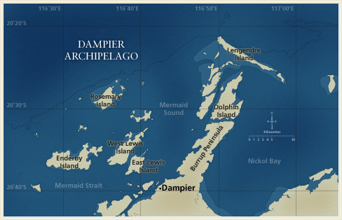
Distribution by Station:
- DA1/98/01 — E side of the N tip of Dolphin Island
- DA1/98/02 — E side of Dolphin Island
- DA1/98/03 — N side of the SE end of Legendre Island
- DA1/98/04 — Off N coast of Legendre Island
- DA1/98/06 — N shore of Hauy Island
- DA1/98/07 — Near S end of the W coast of Gidley Island
- DA1/98/08 — Mid point of island, off W coast of Angel Island
- DA1/98/10 — Passage between Angel and Gidley Islands
- DA1/98/13 — N side, near W end of Hamersley Shoals
- DA1/98/14 — W entrance to channel between Gidley and Unnamed Islands
- DA1/98/15 — Cape Legendre at NW end of Legendre Island
- DA1/98/17 — Flying Foam Passage, Wilcox Island
- DA1/98/18 — Bay near the S end of the E coast of Hauy Island
- DA1/98/20 — E side of Collier Rocks
- DA1/98/25 — S tip of Keast Island
- DA1/98/34 — S part of Tozer Island
- DA2/99/17 — E-SE of Sloping Point, Burrup Peninsula
- DA2/99/58 — N-NE of Roly Rock
- DA2/99/65 — NW of light on East Intercourse Island
- DA2/99/77 — NW of the NW point of Goodwyn Island
- DA2/99/84 — E of Tish Point, Rosemary Island
- DA2/99/99 — W-SW of Rocky Head, Enderby Island
- DA3/99/39 — N-NE of Brigadier Island
- DA3/99/40 — W of Brigadier Island
- DA3/99/44 — SE of Gordon Point, Rosemary Island
- DA3/99/45 — NE of Tish Reef, Rosemary Island
- DA3/99/46 — NW side of Kendrew Island
- DA3/99/48 — N side of Goodwyn Island
- DA3/99/49 — S side of Goodwyn Island
- DA3/99/50 — NE side of Bare Rock
- DA3/99/51 — W side of large bay on N coast of Enderby Island
- DA3/99/52 — N-NW of Roly Rock
- DA3/99/53 — NE coast of Enderby Island
- DA3/99/57 — NE of North West Reefs
- DA3/99/58 — Bay on N-NE coast of Enderby Island
- DA3/99/59 — Bay on N-NE coast of West Lewis Island
- DA3/99/60 — Bay on N coast of West Lewis Island
- DA3/99/63 — Bay on SW coast of East Lewis Island
- DA3/99/64 — S coast of West Lewis Island
- DA3/99/65 — SW of Rocky Head, Enderby Island
- DA3/99/66 — S coast of Enderby Island
- DA3/99/67 — N of Nelson Rocks
- DA3/99/70 — SW of Nelson Rocks
Documents
- Diversity and distribution of subtidal benthic molluscs from the Dampier Archipelago, Western Australia; results of the 1999 dredge survey (DA2/99)
John D. Taylor and Emily A. Glover - A survey of the benthic molluscs of the Dampier Archipelago, Western Australia
Shirley M. Slack-Smith and Clay W. Bryce - Feeding ecology of common intertidal Muricidae (Mollusca: Neogastropoda) from the Burrup Peninsula, Western Australia
Tan Koh-Siang