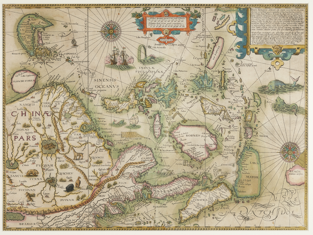
Stop 15 - Accurata Totius Orbis Terrarum Geographica et Hydrographica Tabula Hendrik van Langren, c.1625
This map, made around 1625, is a reworked fragment produced by the Dutch cartographer Hendrik Floris van Langren based on an older world map that he first created around 1599. It shows that within ten years of Dirck Hartogh's 1616 arrival in the Australian region in his vessel Eendracht, the region became marked with a Company presence by the words: ‘the Land of the Eendracht'. Hartogh had left behind a pewter plate recording the date of his encounter with the coast, a very significant object that is currently on display here.
On this map, we see that Hartogh's historic encounter with the Australian continent's west coast was charted onto the map alongside far older and more imaginative speculations about the region encapsulated in other names attributed to it, such as ‘Terra Australis Incognito', ‘Lucach' and ‘Beach'.
In doing so, this map reminds us of the heady mixture of wonder, awe, curiosity, excitement and frustration — the fact and the fiction — of a region that was only just being opened up to European eyes in the seventeenth century.
Since classical times, the existence of a Southern continent or ‘Terra Australis' that balanced the known landmasses in the northern hemisphere had been hypothesised, most notably by Aristotle.
The fourteenth-century Venetian merchant, Marco Polo, added to the sense of excitement about the region when he returned to Europe from his travels in Asia with tales of the kingdom of Lucach, later known as Beach, a place plentiful with gold. Early modern mapmakers expanded on these stories, with imaginative narratives about the people, flora and fauna of this far away region.
For all their practicality, the directors of the Company held on to a glimmer of hope that tales of magnificent creatures, giants and gold might be true. Instructions to captains charting the west coast after Hartog required crews to look out for gold, and to observe carefully the nature of inhabitants, what they wore, how they administered themselves, their industries, housing, village layouts as well as their produce and resources for trading. They scanned the landscape and peoples with great expectations but as they would soon discover, encounters on this continent would not be so easy —and the imagined easy riches fuelled much frustration and disappointment for the Company.
- Next Stop
-

Stop 16 - Kraak Saucer
next